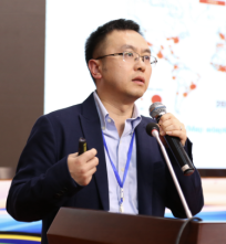
At the invitation of Prof. Jie Yaowen and Prof. Gong Jie from the College of Earth and Environmental Sciences of Lanzhou University and the Key Laboratory of Western Environment of the Ministry of Education, Prof. Yu Bolang from East China Normal University gave an academic exchange and online academic presentation on November 2, 2022.
Speaker: Professor Yu Bolang, East China Normal University
Title: Application of Remote Sensing Data on Nighttime Lighting in Studying Urban Issues
Host: Prof. Gong Jie, College of Earth and Environmental Sciences, Lanzhou University
Time: 19:00-21:00, November 2, 2022 (Wednesday)
Tencent Conference Number: 854-6635-3184
Conference Password: 2209

Specialist Profile:
Yu Bolang is a professor at the College of Geographical Sciences and the Key Laboratory of Geographic Information Science of the Ministry of Education of East China Normal University, and a Young Scholar of the Changjiang Scholar Award Program (2018). His research interests include remote sensing of night lighting, remote sensing analysis of urban spatial information, and remote sensing of urban 3D morphology. He is the deputy director of the Theory and Methodology Committee and member of the Education and Science Popularization Committee of the China Association of Geographic Information Industry, a member of the Photogrammetry and Remote Sensing Professional Committee of the Chinese Society of Surveying and Mapping, a member of the Lidar Professional Committee of the Chinese National Committee of International Society for Digital Earth. He is an associate editor of the Journal of Remote Sensing and Remote Sensing, an editorial board member of the Journal of Spatial Science; a senior member of IEEE; and the recipient of awards such as the First Prize of Shanghai Science and Technology Progress, the Shanghai Youth May Fourth Medal, and the GIS Innovation Personality in Universities.
Report Description:
The report introduced the progress of the research on the application of remote sensing data of nighttime lights to urban issues, including quality improvement of remote sensing data of nighttime lights and key technologies of cross-sensor correction. It studied the spatial structure of the urbanization process (physical attributes), such as the extraction of urban built-up areas, the analysis of the intra-city spatial structure and the spatial structure of urban agglomerations, and the socio-economic structure of the urbanization process (social attributes), such as the estimation of various socio-economic indicators (GDP, electricity consumption, total freight, carbon emissions, material social stock, etc.), the estimation of urban housing vacancy rates, and the estimation of the composite poverty index.